Photo Archive - Butterley to Ironville
This photo gallery shows a number of the images within the FCC archives picturing the canal between Butterley Tunnel and Ironville. More images can be seen on the next page. Please note that the galleries are due to be updated in the near future to use a better viewing system.
Click on any of the images to see a larger version.
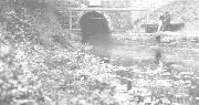
The Eastern Portal of Butterley Tunnel - note the (low) height bar!
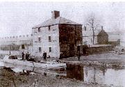
Unfortunately, this fine canal-side building did not survive
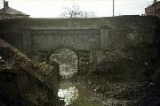
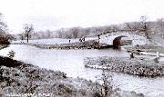
Golden Valley Bridge (Bridge 34) has been buried in connection with road works which have rasied the road level considerably. Mick Golds took this picture of the bridge from the Butterley Tunnel side just before it was buried
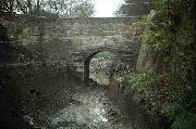
This view is from the Golden Valley side. Notice how deep the canal was!
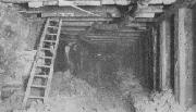
Photo taken 22nd June 1909 when the canal was drained showing work in progress inside the tunnel
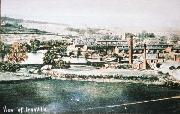
The walk from Golden Valley to Ironville was a very pleasant one, until the reservoir level was lowered by two metres and the canal filled in. This 1960's view by Ian Moss shows the village of Ironville before the council unsympathetically (ie cheaply) modernised and "restored" the houses
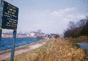
This area looked dramatically different to what it does now when the reservoir and canal were at the same level and the Pinxton Branch was in water
The area around the Top Lock, seen from the hill above Ironville. The Canal is just behind the factory with the two chimneys, and the bridge over the end of the Pinxton Branch is partially visible
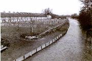
This 1979 photo shows the restored section of canal by the Stone Row at Golden Valley, taken when the cottages had just been restored. Thirty-odd years on, the cultivation of the gardens and trees has totally obscured this view. Also, the bridge this was taken from, though still standing, has now been condemned as unsafe and closed
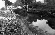
This picture shows the original (wooden) Bridge 35 at Golden Valley which was replaced in the early 1940's by the present structure, which carried the water supply into the hamlet. This was still connected late as 1979, when works to restore the gardens of the cottages broke it, causing a mild flood one Sunday morning.
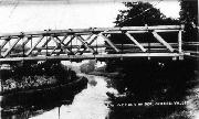
This one of the same bridge was taken from the opposite bank
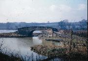
Though it still looked much the same in the 1960's as this Ian Moss photo shows. The arm in the foreground is the beginning of what used to be an arm to Codnor Park Forge, shortened back to a stub 100 or so yards long many years ago. This still exists in the undergrowth and could possibly make off-line moorings in the future
 height bar!)

 has been buried in connection with road works which have rasied the road level considerably. Mick Golds took this picture of the bridge from the Butterley Tunnel side just before it was buried)


 modernised and "restored" the houses)


 Bridge 35 at Golden Valley. It was replaced (we think in the late 1940's) by the present structure, which carried the water supply into the hamlet. This was still connected as late as 1979, when works to restore the section broke it, causing a mild flood one Sunday morning)

