Photo Archive - Bullbridge to Butterley 2
This photo gallery shows a number of the images within the FCC archives picturing the canal between Bullbridge and Butterley Tunnel. More images can be seen on the previous page. Please note that the galleries are due to be updated in the near future to use a better viewing system.
Click on any of the images to see a larger version.
The (road) toll house by what is now the A610 at Buckland Hollow (close to the Excavator pub) has recently been extended. The canal however is now completely filled in. (Photo - George Lynam)
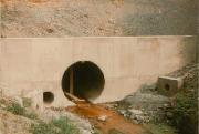
This picture was taken when the A38 was built over the western end of Butterley Tunnel, extending it yet again
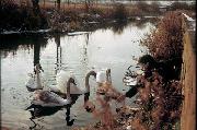
This idyllic scene shows the donor's brother (51 in March 2003) feeding swans adjacent to his parent's house in the late 60's, with the old A610 bridge in background. (donated by Patrick Morriss)
This allowed for the building of a reinforced concrete bed for the twin culvert pipes (a slight tunnelling problem for later!)
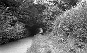
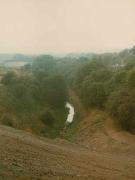
This view of the tunnel at Buckland Hollow can still be seen from the car park of the Excavator pub but the canal is infilled as part of that car park
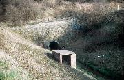
This picture shows the second portal (built when the tunnel was extended over the railway) in Sping 1976 - the marker boards indicate the eventual extent of the A38 embankment
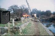
The bed of the canal was dredged
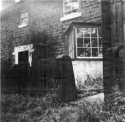
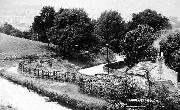
At Sawmills, between Ambergate and Buckland Hollow is a narrowing of the canal where boats were 'gauged' to determine what weight of cargo they were carrying and hence what tolls they had to pay. This is the house that stood alongside with the 'bay' window so that the toll clerk could see approaching boats.
Photograph courtesy of Richard Davies of Victoria BC, Canada
This shows the portal they provided
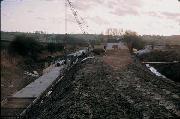
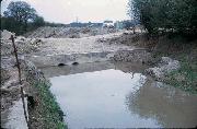
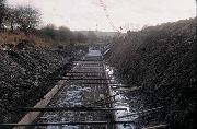
All this was swept away when the new section of A610 was built from the new junction with the A38. This shows drainage work taking place before physical work began - the shed on the left of the picture was used by BW
The pipes to carry the water were then laid on top
 toll house by what is now the A610 at Buckland Hollow (close to the Excavator pub) has recently been extended. The canal however is now completely filled in. (Photo - George Lynam))

 feeding swans adjacent to his parent's house in the late 60's, with the old A610 bridge in background. (donated by Patrick Morriss))
)

 in Sping 1976 - the marker boards indicate the eventual extent of the A38 embankment)


