The Canal Today - Central Section
This photo gallery shows a number of images of the Central Section of the canal as it appears today. Please note that the galleries are due to be updated in the near future to use a better viewing system.
Click on any of the images to see a larger version.
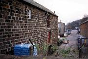
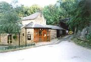
The old course of the Canal through Stevenson's yard
The canal at Lower Hartshay has a little water in it - The Gate Inn is the white building in the background.
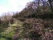
Cromford canal at Sawmills was originally cut to follow the natural land contours. This old path is to the south of the current line. When the Midland Railway built the Ambergate to Pye Bridge line, the trackbed in this area was at approximately the same level as the canal. The direct rail route would have required two crossings of the canal line at Sawmills. To avoid this, a new canal alignment was made running to the north of the railway line. The new alignment removed the old loop, and ran on a built-up embankment. The only evidence of the old route is this Bridge 26a and a short length of depressed ground now in the grounds of Lockwood's depot at Sawmills. Only one side is accessible, the other being bricked up. (Chris Morriss)
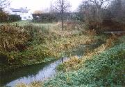
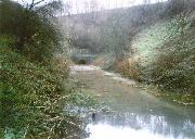
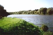
After the heavy rain towards the end of 2002, the normally dry canal bed at Sawmills was looking much more like a 'proper' canal again.
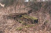
The trunks were stacked in the canal bed to act as wildlife habitats.
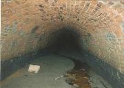
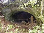
This picture was taken in 1998 during a very dry spell, through the grille at Golden Valley at the eastern end of the tunnel.
The view of the end of the Pinxton Arm was radically changed by the 'flood relief' works of 1985.
Bullbridge Aqueduct embankment: a small arch for a by-road
Please put your canal here! It originally ran under the bridge in the background to the rear of what is now 'The Excavator' pub.
The line of the former Ambergate & Pye Bridge railway which might possibly be used as an alternative route for the restored canal to save disrupting the various gardens now on the original canal line.
Although there was no way of removing the tree trunks.
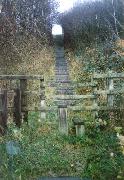
In the opposite direction, there's a stiff climb up to the A610 (and no tunnel for the canal)
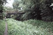
The Canal at Golden Valley is still in water (though very reedy). Bridge 35 has been closed to traffic for some years, as the deck has been pronounced unsafe and it's unclear who owns it.
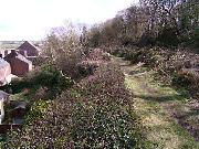
The Canal by Pottery Lock, in Ironville, is barely visible because of the undergrowth.
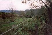
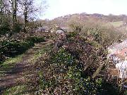
The old maintenance yard alongside the flight is under restoration and the canal is in water (though shallow) making it look more attractive.
Bullbridge Aqueduct embankment: canal filled in and fenced off for animals
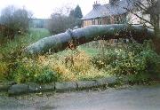
This pipe follows the line of the old bridge at Bridle Lane Hartshay - the bridge is long gone and the canal's been opencasted.
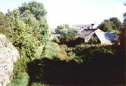
This shot was taken across the 'Lockwood's Gap' - the creation of the new access for the site removed the canal from immediately in front of the photographer to a point in the distance - the glasshouse in the gap in the trees in the centre of the picture is built on the line.
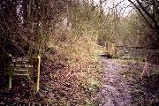
In March 2004, the local householders had a tree cutting exercise which opened up this section dramatically.
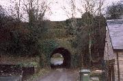
The new western portal of Butterley Tunnel (created when the A38 was built over the end) has never seen a boat.
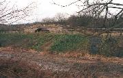
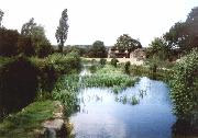
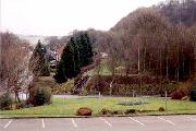
This is the Codnor Park Reservoir, which had its water level lowered and spillways installed at both ends in 1985 as part of a flood prevention scheme which also eliminated Ironville Top Lock. The canal ran through the trees on the left of the photo, with the towpath between the canal and reservoir.
Brian Dominic discovered the remains of the top gates of Ironville Top Lock in the undegrowth beside (and below) Coach Road.


)


)
. Bridge 35 has been closed to traffic for some years, as the deck has been pronounced unsafe and it's unclear who owns it.)

 making it look more attractive.)


 has never seen a boat.)

 Coach Road.)